The Design and Organisation of an Interactive Literary Map for Publication on the World Wide Web.
Graham Stewart – Durban Institute of Technology
Introduction
There can be few more telling examples of the inextricable link between content and delivery than a Web-based gateway to literary information. All the ironies and contradictions inherent in harnessing the Web’s slick, visual medium to deliver the reflective, complex insights of literary work are foregrounded in an endeavour such as this. The Web – and Literature – yoked in common cause? Widely held stereotypes of the Internet’s sleaziness conjure up bizarre displays such as a musical Hamlet, or a Chekov music video. Yet, I would argue that the Internet is uniquely suited to the purpose of information retrieval, and therefore unlikely automatically to reduce or trivialise the information it provides. As a new medium – and a very protean one at that – the Net carries an extensive and often contradictory set of connotations. The jumbled outward appearance of the Internet, for instance, adversely influences our attitude towards online publications. While we have become accustomed to our reading matter announcing itself in familiar printed and bound formats, the Web violates our expectations by delivering everything through a common browser on a computer screen. Why, though, should this deter us when our own bookshelves may happily accommodate an assortment of very different materials, such as the Companion to South African English Literature (Adey et al. 1986) alongside a copy of a novel by Lewis Nkosi? Only more orderly-minded librarians might choose to place the former in the reference section and the latter on the fiction shelf. The disorderliness of the Internet is not that different from our own personal libraries. Once we have overcome the unfamiliarity of the medium and a degree of technophobia, we may find ourselves eagerly exploring the rich possibilities of online electronic reference sources.
Historically, there was a profound shift in the publication medium of reference works during the 1990s. Significantly, in 1993, sales of print encyclopaedias surpassed those of the printed versions for the first time (Rockwell 1996: 13-15). Current editions of encyclopaedias in book form are rare nowadays, and the trend to electronic publication can also be seen in academic journals, where a growing number of readers now subscribe to titles via the Internet and “reference, legal and medical books are on CD-ROM or DVD-ROM and are becoming more Web savvy” (Rao 2003:86). One of the advantages of electronic reference works is the ease of searching for, and retrieving information; another is the inclusion of multimedia elements like photographs, video and audio clips. Print-based reference works with a geographical slant abound. As far as South African literature is concerned, The Atlas of Literature (Cartwright, in Bradbury [Ed] 1996) provides an overview of South African writing linked to geographical location, A Literary Guide to the Eastern Cape: Places and the Voices of Writers (Eve 2003) has recently appeared, and Stiebel (2004) has argued the need for A Literary Companion to KwaZulu-Natal. In Stiebel’s case, the possibility of a “website map of KZN hyperlinked to a CD-ROM database” opened the door to the project described in this paper.
KZN Map project overview:
The KwaZulu-Natal Literary Map on the Web (hereafter referred to as the ‘KZN Literary Map’, or the ‘Map’) forms part of a wider-ranging Literary Tourism project, which examines the past and present written literature of KZN. The KZN Literary Map project explores digital methods of preserving the literary heritage of the province and of promoting literary tourism by means of a website.
Thus the KZN Literary Map itself was designed to function as a literary tourist guide – similar to a book-format ‘Literary Companion to KwaZulu-Natal’ – while at the same time providing an authoritative and evolving research archive of KZN writers and their works. The Map exploits links between literary figures and associated geographical locations, using the relationship between author and place to organise and store information on authors, places, and texts. The Map employs this physical relationship to guide the user, and hence provides an effective information retrieval interface that may operate at various levels of complexity. At a superficial level, the user may use the signposts on the web page simply to discover more about the author, or about the place with which he or she is associated, or to get the contact details of a local tour operator. However, at a more reflective level, users may probe the more ambiguous relationships between the authors and the spaces they inhabit, describe, or originated from, by actually reading extracts from the writers’ work on the website. For further discussion of the levels at which visitors might engage with the literary ‘place’, see the review of Karjalainen’s (1999) notions of literary space below. An additional achievement of the Map is the salvaging of works long neglected or suppressed. Their very appearance on the website denotes re-publication and invites fresh evaluations of the literature.
Accessibility to heritage information has been a major dividend of information and communication technologies (ICTs). Modern digital technologies offer ways both of conserving heritage information, and of disseminating it in an accessible manner via a familiar medium, like the Web. Publishing extracts from KZN authors’ works on the Internet may encourage users to seek out other books by these authors, and facilitate the linking of the present with the past based on the literary heritage sites with which the authors or their works are associated. While an online map can inform and orientate a tourist, it can also provide an opportunity for ‘virtual’ tourists from anywhere in the world to read and learn more about KZN’s cultural heritage without physically visiting the place. Also, presenting heritage information in this manner guarantees a long life expectancy for this information. Bibliographic information on KZN authors and extracts from their works are preserved in digital form, and the website may also be used as a repository for the output of new writers. At the same time, the online map may also be used to generate interest in cultural tourism, and attract tourists to visit the area in person.
In this first phase of the KZN Map project, there was an attempt to follow three disparate but intertwined research trajectories: (a) the location of the literary map in a theoretical context, (b) finding ways to translate the theory into practice (in this case, an information and communication technology – ICT – developmental process), and (c) building the research capacity of the students on the project team.
As Figure 1 suggests, the overall success of the research project could best be assessed by measuring the extent of the area where all three circles intersect, in other words, where all three aims were accomplished. Ideally, what we hoped to achieve was the development of an effective literary map cum digital archive, founded in an appropriate theoretical context, and involving the active participation of apprentice-learner research members.
In the course of this report, each of the three aims will be considered, and the rationale for each discussed. Our working hypothesis was: ‘a web based literary map linking literary figures and geographical sites would contribute to the conservation of KZN’s cultural heritage and promote literary tourism’. Evidence so far in support of this contention consists of (a) positive evaluations from the evaluation panel during successive revisions of the prototype; (b) an enthusiastic reception by delegates at the ‘Writers, Place and Identity’ colloquium held in KZN in December 2003; and (c) a sharp increase in the number of website ‘hits’ following a review of the site in a local newspaper (Coan 2003). Perhaps the most compelling support was the interest shown by the provincial Tourism authority, Tourism KZN, in linking the Map to their Internet portal, Zulukingdom.org (See the Conclusion, below). As the project is still very much a work in progress, there are still many answers to be sought, for example, a survey of users of the map (literary tourists and academics alike), followed by a critical analysis of the extent to which the expectations of these user groups are being satisfied.
Theoretical context:
Sources consulted for the purpose of designing the first prototype of the KZN Literary Map included research reports from a range of disciplines, all of which had a bearing on the content and design of the web site. The theoretical framework for the project drew on Human Geography and Literature, while the information design looked to Informatics and website design. Key to an understanding of the project as a whole is the background provided by Stiebel (2004) who outlines the research agenda for the broadly-based Literary Tourism project of which this present KZN Literary Map project is a component. The ‘umbrella’ Literary Tourism project under which the Map project falls, has three major aims:
… to collect a database of all published KZN writers past and present in all languages of the region on CD-ROM; to link this database to a literary tourist map of KZN on a website such that places associated with writers are highlighted; and to produce documentary films on selected, representative KZN writers aimed at literature students and literary tourists alike (2004).
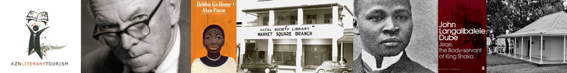
Stiebel goes on to consider the phenomenon of place as locus of significance constructed by the experience of the viewer, a notion also extensively explored by Tuan (1991). Stiebel draws attention to the process by which a “’real’ physical place [is] transformed into a country of the mind by both writer and reader”. KZN may offer its own local versions of literary guides like those of ‘Hardy’s Wessex’ or ‘Dickens’s London’. Recreations of KZN landscapes might invoke the romanticised idyll of Rider Haggard’s Zululand or the imaginative richness of Alan Paton’s descriptions of the Umkomaas Valley.
Karjalainen (1999) provides a helpful schema for identifying the various components, physical, emotional and intellectual that can be said to define a literary ‘place’. Starting from a definition that isolates ‘place’ as “those ‘pieces’ of terrestrial-spatial reality that have been claimed by human intentions”, Karjalainen proposes a taxonomy that allows for the interpretation of place from three possible angles: the mimetic, hermeneutic and textual. By mimetic, he means the transcription of the physical reality of the place (e.g. using Latitude and Longitude co-ordinates). The same locality can be approached through hermeneutic analysis, whereby the viewer imbues the place with subjective meaning – an interpretation of the outer world by the inner world of the individual. The narrator of South African novelist Justin Cartwright’s White Lightning makes the following telling observation as he walks along a familiar farm track near his home, having returned after many years abroad.
Every detail of the landscape was familiar to me, and these details seemed to be calling to me on private frequencies although the gist of their message was unclear. (Cartwright 2002:3)
The KZN Literary Map on the Web shares this recognition that literary landscapes are capable of calling to us on just such ‘private frequencies’, and that there is intrinsic value in the significance that a literary tourist may find in imaginative places triggered by associations with much-loved books or authors. Likewise Tuan (1991) refers to London tourists entering the world of Conan Doyle through a visit to Baker Street, while Squire (1993) observes that tourism allows people to escape into dreams and idylls of an imaginary literary landscape very different from their everyday lives. In her study of tourists who visited the Lake District home of author Beatrix Potter, “she found that this ‘literary’ tourist experience ha[d] been appropriated by tourists to fulfill a range of their social and cultural needs. In the nostalgia for a bygone age, many of her respondents valued tourist experience as a medium to encounter a lost, hence idealized, rural past” (Ateljevic 2001).
The leap from a mere association of locality and emotion to the much more profound experience of immersion in an imaginative world as described by Squire (1993), brings us to Karjalainen’s third level of definition of place: the textual. By ‘textual’ he means the shifting interplay between the viewer or visitor, and his/her constantly changing interpretations of the text with which the place is associated. One may grasp the enthralling nature of such an interaction more easily if one thinks of the spiritual experience that may accompany a visit to a sacred site.
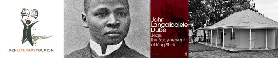
Let us apply Karjalainen’s taxonomy to a place associated with one of the authors in the KZN Literary Map – the house of the distinguished South African, John Langalibalele Dube. Analytically, the literary ‘place’ can be depicted diagrammatically as follows:
PLACE AS MEASURED
Cartographic: unique location
29.69548 S 30.9429 E = Inanda, KZN, in the form of co-ordinate indices
PLACE AS LIVED
Existential: unique experience
Being at home = Inanda, KZN, for a permanent dweller
Paying a visit = Inanda, KZN, for an occasional visitor
In addition to the co-ordinates, further information from the Zulukingdom.org.za interactive map (2004) includes the fact that the house is 500 metres from the Ohlange Institute. Also, that the house was built in 1906 for John Dube, founder and first principal of the Ohlange Institution, and that he was also first president of the African National Congress (ANC). The house is now a South African National Monument. While the Zulukingdom.org.za data provides the basis of the mimetic experience, the Literary Map information builds on this to facilitate hermeneutic and textual experiences. For example, the visitor learns from the Map that Dube established the first Zulu language newspaper, Ilanga lase Natal, in 1903 and that he wrote a novel, Jeqe, the Bodyservant of King Shaka, information that invokes Dube’s political activism and the glories of a past Zulu empire. Drawn in further by details of the locality, an observant visitor will notice that almost next door to Dube’s house is the Gandhi Settlement, the site of Sarvadaya ‘the place of spiritual upliftment for all’, established by the young Gandhi who lived and worked in this part of KZN in the early 1900s. The settlement is a sacred heritage site, and a focal point inviting a spiritual journey in the footsteps of the Mahatma.
The immersive experience of the website visitor (the virtual tourist) or of the visitor to the ‘real’ Inanda match Urry’s (1990) observation that “Various forms of non-tourist social practices, such as literature, film, TV, magazines, etc, feed the expectations”. Tuan coined the term ‘topophilia’ to describe this phenomenon, and he specifically draws attention to how the world of fiction “can profoundly infect the real world” (Tuan 1991).
The marked disparity between the social realties (poverty, high levels of unemployment) of the permanent dweller of Inanda and those of the affluent visitor (both material and imaginative) are flagged by the ‘place as lived’ component of Karjalainen’s taxonomy. A discussion of the principles and practice of sustainable heritage tourism lie beyond the scope of this study, but the potential payoff in tangible benefits for the communities living at or near heritage sites are important drivers for this project, and the broader KZN Tourism project of which it forms a part. Shackley draws attention to this aim by monitoring the shift in South African tourism from apartheid era cultural products “dominated by sites connected with its European cultural heritage, including the legacies of the Anglo-Boer and Anglo-Zulu wars” to the promotion of “attractions based on the history of its non-white population in an attempt to redress the balance” (Shackley 2001:357). The more general imperatives and benefits of cultural tourism are spelt out by Périer-D’Ieteren who argues for “a fair balance between the needs of tourism, legitimate national concern to make the most of the heritage as a source of essential economic benefit, the prerogatives of the tourist industry and, lastly, the need to safeguard the heritage in the broad sense of the term, that is, any material or intangible trace containing the memory of the past, so as to ensure its durability” (Périer-D’Ieteren 1998:5).
Another influential secondary source in the design of the KZN Literary Map was Bradbury’s The Atlas of literature (1996), a print-based literary map that brings together literary writers, books, and the cities of the world, in a coordinated way. By means of annotated maps and copious illustrations, the Atlas presents real and imaginary maps of literature past and present. The various chapters present writers and works that are intimately connected with a place or landscape. In addition, the Atlas shows the key places related to the making of literature, the communities in which the authors worked and the places they met. The choices made by Bradbury were helpful indicators of the range of relationships amongst writers, places and their published work that could inform our own selection of writers for inclusion in the KZN Literary Map. The Atlas has a chapter on the growth of literature in South Africa and highlights the townships and cities where famous literary figures, journalists, and singers like Miriam Makeba, lived and met, through the difficult years of apartheid oppression (Cartwright 1996: 294). The Atlas is a helpful example of the contribution a literary map can make in contextualizing information on writers and literature, and in exploring the types of connections to place that might guide the curious literary tourist.
The advantages of using digital technologies for managing map-based information, and for making it more accessible to users are highlighted by several authors (Johnson 2002: 13-18, Delazari and Cintra 2002). A digital map can become a database, allowing disparate bits of information to be collated and stored for systematic retrieval. Such a database is flexible and can be easily expanded while offering considerably wider accessibility than printed sources: “…Electronic atlases […] are highly interactive and allow users to visualize, to select information, and to navigate among different data representations. In essence, they permit the analysis and processing of spatial data, the use of multimedia components, and the functionality of Geographic Information Systems (GIS)” (Delazari and Cintra, 2002:1). The future development of the KZN Literary Map is located within a GIS framework, specifically the Zulukingdom.org heritage database.
Capacity building:
Integral to the participation of my own institution (the Durban Institute of Technology) in the KZN Literary Map project was the involvement of a research team comprising final-year Bachelor of Technology students from previously disadvantaged backgrounds. Their contribution to the project included the review of related literature, website and information retrieval design, and assistance in the preparation of successive Map prototypes for evaluation. There were three students in the team, each with a distinct role function:
- Graphic and text design aspects (image creation, word processing, website updating)
- Website design
- Database design
All three learnt the basics of website design, and then went on to review the literature in their specific areas. The close collaboration of the research team members positively influenced the overall progress of the project, and enabled the relatively speedy development and evaluation of the first three prototypes. Two of the students successfully completed their degrees at the end of the first year of the development, while the third went on to work on the project for a further year as a research assistant. Their individual contributions are embedded in the third prototype, and their input can best be judged by the success of the Literary Map itself, and the account of its development that follows.
Information and communication development –An account of the development of the Map:
A map-like encyclopaedia or an encyclopaedic map? This question underpinned the information design element of the KZN Literary Map project from the start, and led the research and development team from their initial linear book-like conception of the literary map, through to a more hypertextual and information rich website space, and eventually to a sense of the resource as a literary-rich dimension of a much broader geographic information system (GIS) on the KwaZulu-Natal province as a whole.
Building the KZN Literary Map required a developmental methodology involving the creation of a series of prototypes, each of which was subjected to a critique by an evaluation panel (senior research team members from both collaborating institutions) to improve and refine the content and the design. The first prototype arose out of an analysis of primary materials (such as existing online maps – for example, BBC Online’s interactive maps of the 2003 war in Iraq), on published accounts of similar developments (Hockey 1997, McGann 1998, Stewart 2001), and the review of articles of a more general nature dealing with website and database design. As discussed earlier, an important element of the research was the upskilling of the participants: new software, hardware and network capacities were required to author, manage and publish the Map. Figure 3 provides an outline of the research process. Spread over a ten month period, the final prototype in the current phase of the project (Prototype 3) incorporates the sum of the design inputs of the research team, along with the recommendations and improvements mad by the evaluation panel in the two rounds of evaluation.
In the course of the research, an important question that had to be addressed was which authors could be claimed as ‘authentically KZN’ and to what extent writers’ real and fictional spaces might impact on decisions to include them on the Map. To begin with, authors born in KZN or who write or live in the province were included, but issues around the inclusion or exclusion of certain writers continue to be addressed. The end of the first stage of the project was marked by the launch of the final prototype web site (http://salit.dit.ac.za/) in December 2003. From the home page, users may select any one of the authors from the drop-down list. There are currently nineteen authors represented, ranging from the Victorian era Rider Haggard to present-day author Gcina Mhlope. Each author page includes a short biography, an extract from the writer’s work and a bibliography. The clickable map leads the user to the town or region associated with the author.
The researchers collated and analysed the feedback from the evaluation panel and used the findings to edit the prototype sites. As can be seen from the discussion below, this resulted in significant improvements, both to the site’s information design, and to the development of the content, i.e. growing the author base, selecting appropriate textual passages, and composing biographical sketches.
Here is a summarised account of the revisions following the evaluation of the prototypes:
Prototypes 1 and 2
Map Design: Feedback from the evaluation panel on Prototype 1 led to changes that included (a) more explicit instructions for users, (b) separate hyperlinks for author and place, (c) adjustment of the map display to fit 800×600 pixel screens, (d) layout changes to accommodate author and place information on the same page, and (e) the addition of more images for authors and places. The most important change to the physical appearance of the map was that from the large ‘topographic’ image used in Prototype 1 to the more compact clip-art style map (showing KZN as a slice of the SA map) of Prototype 2. The change allowed for more author-specific textual information to be accommodated on the immediately visible top section of the web page including a portrait of the author) along with the prominently-placed map emphasising the connection to place.
The map graphic has the capability of indicating (by way of a conspicuous red flag) the place with which the selected author is associated. The flagged place, as well as the other place names contain embedded hyperlinked hot-spots that, when clicked, retrieve the ‘Place’ related HTML page.
Content: The initial list of six authors was drawn up by the Map researchers and the Literary Tourism research team leader. Criteria for selection were place of birth, setting, i.e. authors whose writings are about KZN; and residence, i.e. authors who may not have been born in KZN but who have lived and worked in the region. Biographic, photographic, and bibliographic information together with full text excerpts from authors’ work and review material were included.
After four months during which the above revisions were made, Prototype 2 was published on the Web and another round of evaluations completed. Subsequent revisions to the Map are summarised below:
Prototypes 2 and 3
Map Design: Relatively few changes were made in Prototype 3. The red flag graphic was altered so that the points of the flag-arrows were more closely aligned with their associated place names. The content areas on the author pages were re-ordered to bring the ‘Selected Work’ excerpt into a more prominent position on the page, and more in-page navigational links were added (‘contents’, and ‘top of page’).
Content: Most of the revisions to Prototype 2 related to the addition of new authors to the site. The selection criteria remained the same, but the search for authors was extended to encompass a wider range of sources, and include a more representative ethnic and gender mix. A summary of the sources consulted for the list of thirty-four authors that appeared in Prototype 3 is given below:
· The original list compiled for Prototype 1.
· Authors identified as having been born in KZN from Adey and Chapman’s Companion to South African English Literature (1986).
· Stiebel’s article ‘Hitting the ‘hot-spots’’ (2004).
· Recommendations of the second evaluation panel meeting.
· KZN authors identified in Bradbury’s Atlas of Literature (Cartwright 1996).
The number of authors included on the Map was kept low deliberately during this developmental phase so that infrastructural issues like website layout could be adapted relatively easily, and accommodate the feedback and recommendations made by the evaluation panel and other research team members. The SALIT database (van Wyk and Stewart 2001) contains 876 KZN-related author entries, and an exploration of these more marginal writers may be undertaken in later stages of the project.
An account of the database development process:
The development of a database to store the Literary Map information was integral to the original project design, although the more recent collaboration with Zulukingdom.org.za has radically changed this aspect of the design (see the Conclusion, below). In Prototype 1, the file and directory structure of the website itself was used as a database, with systematic file labelling (e.g. a_paton.htm, or p_eshowe.htm) indicating both the type of information (a = author content, p= place content) and the primary record titles (author surnames and geographic place names). This semi-database procedure created a consistent sorting regime both for categories and (alphabetically) for author surnames. Although conceived as a temporary measure, this approach promoted not only the orderly creation and revision of content, but also contributed to the hybrid database management solution eventually adopted in Prototypes 2 and 3 (See Figure 4).
Links from the Prototype 1 Map to author and place information were therefore direct HTML hyperlinks (<a xhref=). The author name list was not automatically generated, but required explicit entry and ordering of new search terms (in this case, hyperlinked author names) followed by the revision and re-saving of the HTML file. Although the procedure was a little cumbersome, it served a useful purpose by making the website fully operational during the first phase of website construction, when issues of appearance, content and navigation were being tested.
Prototype 2
An Access database with an ASP link to the website was created for the second phase of the project. Feedback from the evaluation panel had indicated the need for the inclusion of the following content elements for each author page: a short biography, a selected bibliography, and a representative excerpt from the author’s work. These in turn gave rise to the fields in the ‘Author’ table of the KZN Map database. Although a ‘Places’ table was included in the database, it soon became clear that in view of the relatively low level of complexity of the relationships between authors and places, it was unnecessary to absorb the Place information into the database itself. The ‘Place’ HTML files were thus left in their original location in the website directory tree structure (See Figure 4).
The database software allowed for search engine capabilities (website-to-database) permitting user entry of search terms to retrieve matching records. However, the evaluation panel feedback recommended the addition of a drop-down list to supplement the search box. A solution was found outside the Access/ASP setup in the form of Javascript embedded in the HTML search page. The Javascript allowed for (a) a list of author names to be entered into the HTML search file, and (b) for the script to retrieve matching records from the database. It was decided that the advantages of the this drop-down list in terms of user-friendliness outweighed the disadvantage of having to revise the Java list each time a new author record was added to the database by the developers. The design that was retained includes the drop-down list on the main search page, and the search box on the individual author pages. Alongside the search box is a hyperlink back to the main search page. The user may thus choose to move on by using the search box, or by returning to the main page drop-down list. Unlike the drop-down list, search parameters for the search box would, however, continue to be updated automatically through the basic ASP link. In its new home on the Zulukingdom.org website, the Literary Map has kept the drop-down author list.
In Prototype 2, the elements of the author page that were retrieved directly from within the database were (a) the author’s name, and (b) the HTML document itself including the three content elements identified above. Residing outside the database itself, and stored in the web page structure were (a) the Place HTML documents and (b) image files, including portraits of the authors and the KZN Map graphics.
Prototype 3
Inputs from the evaluation panel after the second round of evaluation had established a list containing the names of thirty-four authors. As this point, each of the authors were searched and flagged in the existing SALIT database (van Wyk and Stewart 2001). A report subsequently generated from this query was used as the definitive set of data for transfer to the KZN Literary Map database, and necessitated the addition of the following fields: date of birth, date of death and place of birth. Additional biographical and bibliographic data contained in the SALIT database was not transferred, but retained along with the other reference materials (Companion to South African English Literature – Adey et al. 1986, etc) as a possible source of information for the author pages.
Conclusion:
The publication of Prototype 3 in December 2003 marked a watershed in the development of the Map. While ensuring sound academic input into the design, the participation of the evaluation panel during the recursive evaluation-redesign-evaluation cycle also brought KZN tourist authority professionals into the process. A side-effect of this participation has had a profound effect on the future development path of the project – the researchers have entered into an agreement with KZN Tourism to make the Map part of the KZN Province’s principal online tourism gateway: Zulukingdom.org.za (http://literature.kzn.org.za/lit/index.html). Apart from the benefits of wider exposure to users, the Zulukingdom.org.za link provides an excellent solution to some difficulties in the present project of effectively integrating locality maps into the website. Instead of general town or city maps (as is presently the case in Prototype 3), specific localities and route maps will be available to the Literary Map user via cross –links to the Zulukingdom.org.za’s Geographic Information System heritage site database. Their database contains over 1000 sites of cultural significance in KZN, including some to literary figures (see John Langalibalele Dube example, above). The KZN Map project research team will take responsibility for adding more literary-specific localities to the GIS database during the transfer of the map to its new server location.
Bibliography:
Adey, D., R. Beeton, M. Chapman, 1986. Companion to South African English Literature. Craighall: Ad. Donker.
Ateljevic, I. 2001. Chapter eleven: Tourist Motivation, Values and Perceptions. In Woodside, A. et al. Consumer Psychology of Tourism, Hospitality and Leisure. New York: Oxford University Press.
BBC Online. 2003. Iraq Navigator. Mapping the Conflict. BBC News Website. Retrieved 15 April 2003, from the World Wide Web: http://news.bbc.co.uk
Bradbury, M. (Ed.) 1996. The Atlas of Literature. London: De Agostini Editions.
Cartwright, J. 1996. South African Stories. In The Atlas of Literature. Bradbury, M. (Ed). London: De Agostini Editions. 294-297.
Cartwright, J. 2002. White Lightning. London: Sceptre.
Coan, S. 2003. Literary Landscapes The Witness. 16 December 2003.
Delazari, L.S. and Cintra, J.P. 2002. Is an Electronic Atlas a Geographic Information System? Conference Paper: International Congress of Geodesy and Cartography. Caracas, Venezuela. Retrieved 12 January 2003, from the World Wide Web: http://www.asovig.org/Documentos/Stamato%20L_Cintra%20J_Atlas.pdf
Eve, J. 2003. A Literary Guide to the Eastern Cape. Double Storey.
Goulding, C. 2000. The commodification of the past, postmodern pastiche, and the search for authentic experiences at contemporary heritage attractions. European Journal of Marketing. 34: 7. 835-854.
Hannabuss. S. 1999. Postmodernism and the heritage experience. Library Management. 20: 5. 295-
Henry, G. 2003. On-line Publishing in the 21st Century. Challenges and Opportunities. D-Lib Magazine. 9(10). Retrieved 22 October 2003, from the World Wide Web: http://www.dlib.org/dlib/october03/henry/10henry.html
Hockey, S. 1997. Making Technology Work for Scholarship: Investing in the Data. Paper presented at the Scholarly Communication and Technology Conference, Emory University April 24-25, 1997. Retrieved 2 April 1998, from the World Wide Web: http://www.mellon.org/
Johnson, N. 2002. Animating Geography: multimedia and communication. Journal of Geography in Higher Education. 26:1.13-18. Retrieved 12 January 2003, from the World Wide Web: http://search.epnet.com/direct.asp?an=6113123&db=aph
Karjalainen, P.T. 1999. Place and Intimate Sensing. The Thingmount Working Paper Series on The Philosophy Of Conservation. Lancaster: British Association of Nature Conservationists.
McGann, J. 1998. Textual Scholarship, Textual Theory, and the Uses of Electronic Tools: A Brief Report on Current Undertakings. Victorian Studies. 41(4): 609-619.
Périer-D’Ieteren, C. 1998. Tourism and conservation: striking a balance. Museum International. 50: 4. 5-15.
Pinna, G. 2001. Heritage and ‘cultural assets’. Museum International. 53: 2. 62-65.
Rao, S.S. 2003. Electronic books: a review and evaluation. Library Hi Tech. 21(1): 85-93.
Rockwell, G. 1996. Hypertext in the humanities. Electronic Texts in the Humanities: Methods and Tools. General Handbook.Princeton: Centre for Electronic Texts in the Humanities. Section 9: 1-19.
Shackley, M. 2001. Potential Futures for Robben Island: shrine, museum or theme park? International Journal of Heritage Studies. 7: 4. 355-364.
Squire, S. 1993. Valuing countryside: reflection on Beatrix Potter tourism. Area. 25. 5-10.
Stewart, G.D.J. 2001. Renaissance in Cyberspace: Creating the SA Literature Subject Directory. Paper presented at the 3rd CSSALL Conference. University of Durban-Westville, 6-7 July 2001.
Stiebel, L. 2004. Hitting the ‘hot spots’ in literature: literary tourism as a research field in KwaZulu-Natal, South Africa. Critical Arts 18(2): 31-34
Tuan, Y.-F 1991. Language and the making of place: A narrative-descriptive approach. Annals of the Association of American Geographers 81: 4. 684-697.
Tuan, Y.-F. 1974. Topophilia: a study of environmental perception, attitudes, and values. Englewood Cliffs, N.J.: Prentice-Hall.
Urry, J. 1990. The Tourist Gaze: Leisure and Travel in Contemporary Societies. London: Sage.
van Wyk, A.J. and Stewart, G.D.J. 2000. The SALit CD-ROM: A virtual library of South African literature. Proceedings of CITTE 2000 Conference on Information Technology in Tertiary Education. University of Port Elizabeth, 28 June 2000. Retrieved 19 April 2002, from the World Wide Web: http://www.upe.ac.za/citte2000/abstract.asp?ID=38
Yawney, M. 2002. How about ‘Hamlet! The Musical’. Shaksper. The Global Electronic Shakespeare Conference. Electronic discussion group entry. SHK 13.2114 Tuesday, 22 October 2002. Retrieved 23 October 2003, from the World Wide Web: http://www.shaksper.net/archives/2002/2121.html
Zulu Kingdom.org 2004. Interactive Map of Durban. Retrieved 3 May 2004, from the World Wide Web: http://www.kzn.org.za/kzn/action/7.xml